| Location: Barbury Castle is about five miles south of Swindon and the M4, on the northern edge of the Marlborough Downs within the North Wessex Downs Area of Outstanding Natural Beauty. Other than a couple of nearby farms, there is no current settlement near the site. By road the site can only approached by a single road ascending the scarp slope of the downs from midway along the B4005 between Wroughton and Chiseldon. More options are available by foot or horseback, including the Ridgeway, which runs west to east along the edge of the downs, and a byway south across the downs to Marlborough. Position: grid reference SU149762 Nearby towns and cities: Swindon, Marlborough Nearby
villages: Wroughton, Chiseldon |
 | Viewing Options Once
at the car park there are a number of choices for viewing. On a quiet night when
there are very few or no other members of the public around the car park itself
has a good hardcore surface from which to view. |
| Avebury Avebury is the site of a large henge and several stone circles in the English county of Wiltshire surrounding the village of Avebury. It is one of the finest and largest Neolithic monuments in Europe dating to around 5,000 years ago. It is older than the megalithic stages of Stonehenge, which is located about 32 kilometres (20 miles) to the south, although the two monuments are broadly contemporary overall. It lies approximately midway between the towns of Marlborough and Calne, just off the main A4 road on the northbound A4361 towards Wroughton. The henge is a Scheduled Ancient Monument and a World Heritage Site. Avebury is a National Trust property |
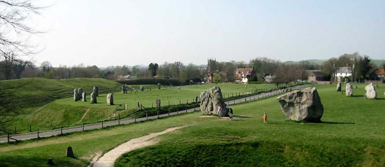 |
| Viewing
Options The advantage of Avebury is that you get really dark skies there. The field opposite the Red Lion pub is a great spot to view from and easily accessible, always great for a little refreshment and warming the bones afterwards! The disadvantage is that you have to be really careful where you go, bearing in mind that this is a National Trust property. Walkers of course are allowed at most times (the car park is closed at night), however, you must be ultra-careful about what equipment you use as you are not allowed to stick anything in the ground or disrupt the site in any way, so a good pair of binoculars or a light, unobtrusive refractor is really the order of the day. But this is a great site for viewing, and you get fantastic views and great dark skies, great for observing nebulae and deep sky objects. Shooting stars are also frequently seen here, so a great spot, but do take care! Recommended by Robin Wilkey Photograph courtesy of Wikipedia |
|
If
you have any ideas on viewing sites and would like to share them with
others
please contact: Damian Ohara |
|
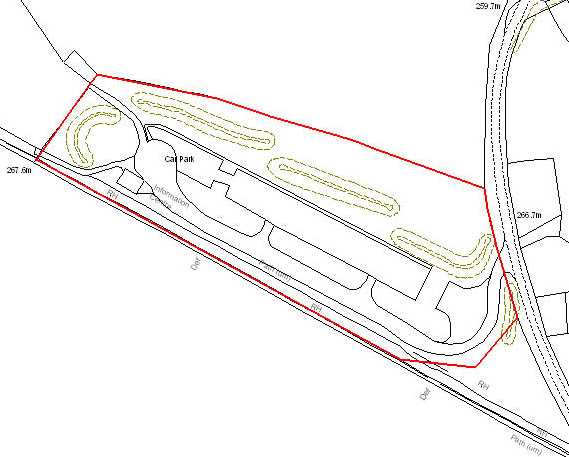
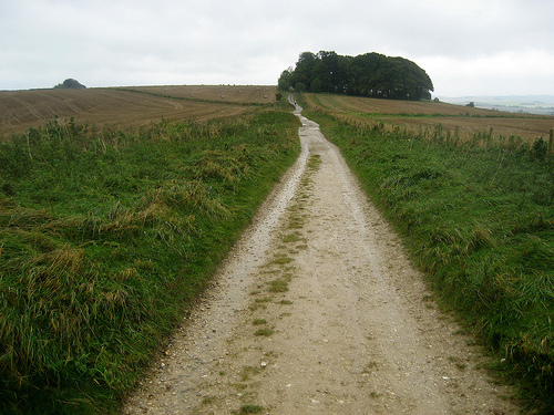
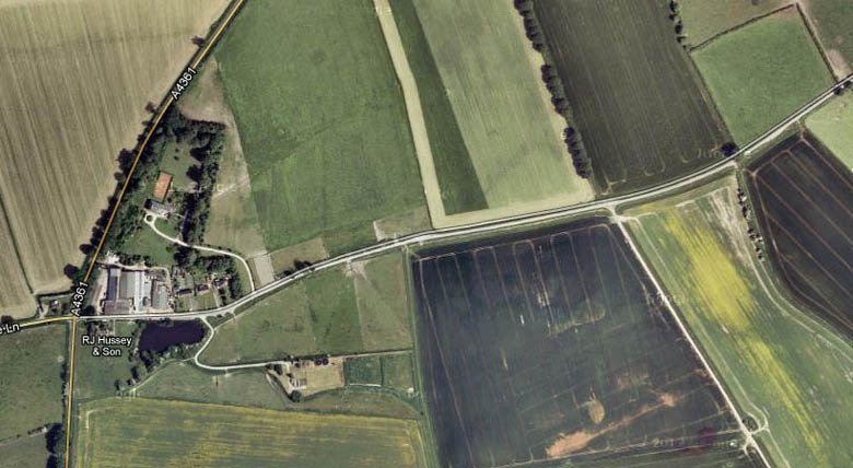
East
Kennett - Borham Viewing
can be carried out in the area shown below. Further up the hill the road is single
track and so it is best to go no further than 150yds, ample space for a couple
of cars and telescopes etc. | |
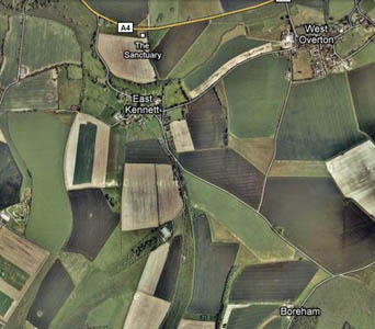 | 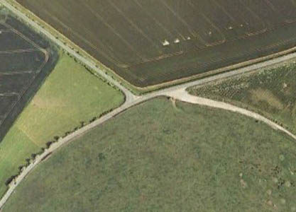 |
| Recommended
by Robin Wilkey Photographs courtesy of Google Maps & Google Earth | |
|
Uffcott, near Wroughton, Swindon Take the A4361 out of Wroughton towards Avebury for about a mile, at the second sign for Uffcott take a left turn towards the village, on the corner is an open aspect farmyard and it will feel like you are driving into the farm complex, but continue driving along the country lane for about half a mile and on the left you will find a layby which is our viewing spot. If you accidently take the first turning to the village then just drive through the village and out again and you will arrive at the same spot, but it will be on your right. |
 |
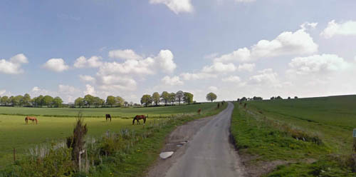 |
| Recommended by
Michael Partridge and Pete Chappell Photographs courtesy of Google Maps & Google Earth |
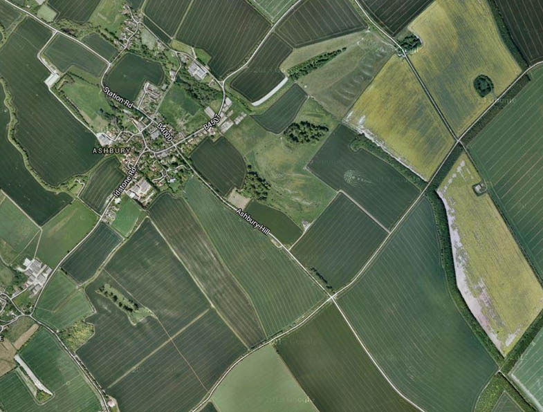
| Ashbury Hill - Ridgeway |
| A good site for viewing is near Ashbury, where the B4000 crosses the Ridgeway (Google Maps) which is basically at the top of Ashbury hill on the Ridgeway. There is plenty of parking and there are fairly unrestricted views, it takes about 20 mins drive out of Swindon. There is occasional traffic at night, but if this bothers too much you can always walk a little way along the ridgeway. (Mark Ackland) |
 |
 |
|
Aerial Photo: Courtesy of Google Maps Recommemded by Mark Ackland |
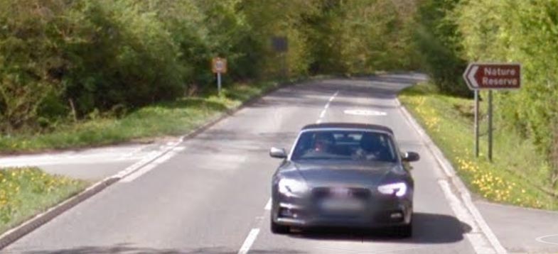
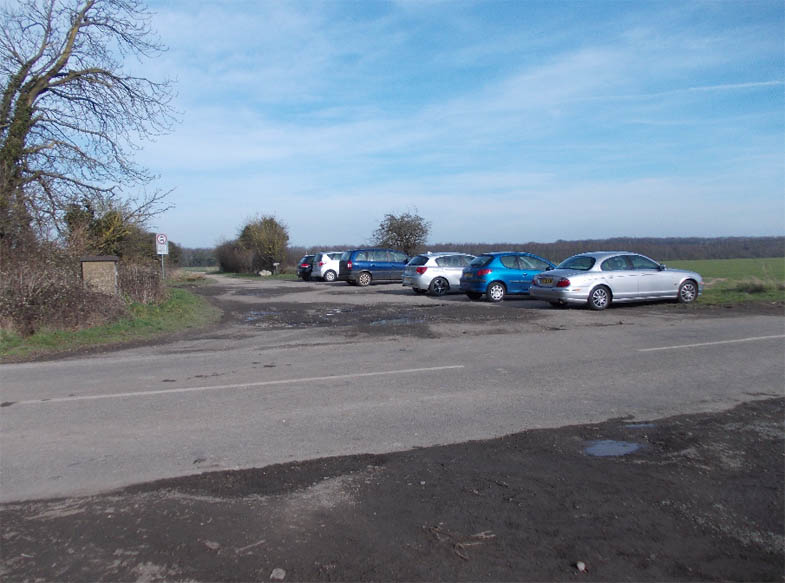
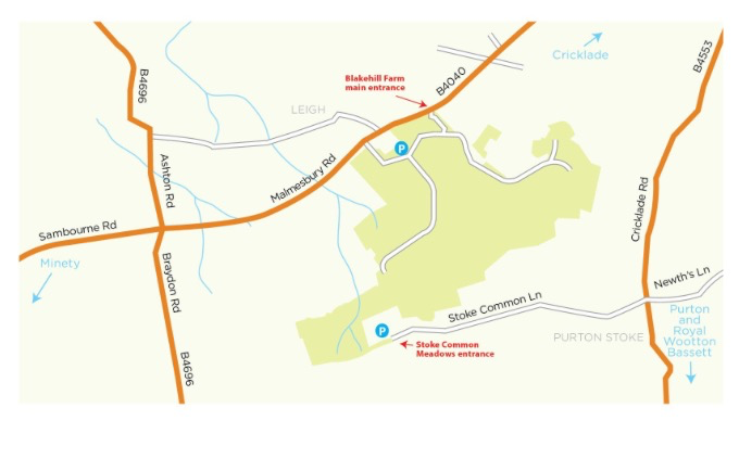
| Blakehill Farm Nature Reserve |
| The reserve is signposted
off B4040, Malmesbury Road, between Minety and Cricklade, adjacent to
the village of Leigh. From Cricklade drive about 1.3 miles from the edge
of town. The reserve entrance is on the left about 100 yards after entering
Leigh. From Minety drive about 3.2 miles. Reserve entrance is on right
about 0.5 miles after the Forester’s Arms pub. For the car park follow
the signs from the new vehicle access road.
For Sat Nav users enter SN6 6RA (My Sat Nav said I was there but I needed to go on a couple of hundred yards where there is a large brown sign (Wiltshire Wildlife Trust) and then another hundred yards to a smaller brown sign indicating the access point.) |
 |
|
The
site is well signposted at quarter of a mile and then at the entrance
(see above) |
|
More Info: Blakehill Farm Nature Reserve Recommended by Swindon Stargazers Committee |
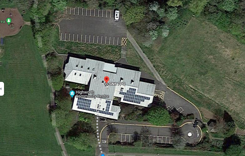
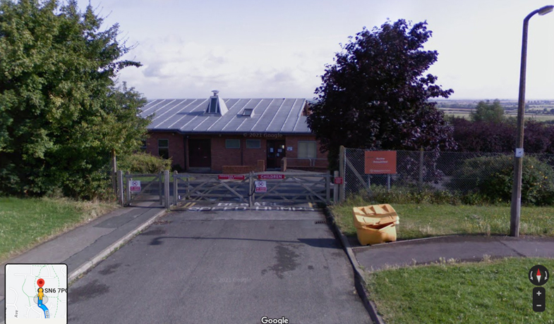
| Highworth Community Centre |
 |
|
Highworth Community Centre is the perfect viewing spot for beginners, with ample facilities, toilets, kitchen and inhouse rest area and adequate parking in the lower overflow car parks. There are several viewing spots with hard-standing, including the terrace outside the back of the community centre. Address: Highworth Community Centre, The Dormers, Highworth, SN6 7PQ Directions: Take the A361 out of Swindon. At Highworth, drive over the first roundabout keeping on the A361 towards Lechlade and Burford. At the next roundabout after passing the Shell garage take the second exit (RIGHT) sign-posted Faringdon onto the B4019. At the next (Eastrop) double mini roundabout go straight across in the direction of Haresfield. Once over this take the first turning LEFT into Priory Green. Highworth Community Centre is signposted here. Continue along Priory Green turning third RIGHT into The Dormers and on the bend turn LEFT at the signpost for Highworth Community Centre. There is a concealed newsagent and general store on the right hand corner of the road. On entering the community centre follow the signs round to the overflow car parks (there are two). Park in one of these as the viewing areas are at the rear of the building. |
|
Recommended by Paul Newton-Smith (trustee) - Facebook Page: Highworth Night Sky |
 |
Viewing
Sites |
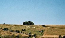
| Barbury
Castle Barbury Castle is an Iron Age hill fort situated in Wiltshire. It is one of several such forts found along the ancient Ridgeway route, and is now managed as a country park by Swindon Borough Council. It is situated on Barbury Hill, a local vantage point, which, under ideal weather conditions, commands a view across to the Cotswolds and the River Severn. It has deep defensive ditches. The Old Ridgeway runs close by and the modern Ridgeway crosses through the castle. |
| We are doing everything we can to organise viewing sessions at Barbury Castle Car Park. This will be an excellent place to meet and set up our scopes, and explore the universe. |